Log in
All resources
Create a design
201 Free Artworks of 1810 Maps
a system of modern geography (1810)
maps in portrait paintings
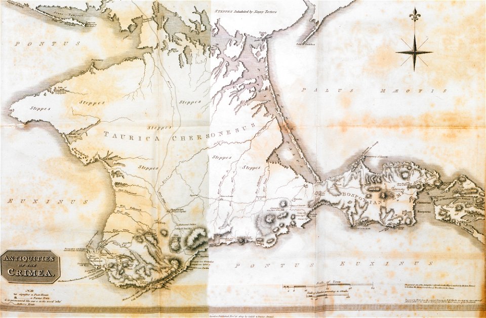
a voyage to abyssinia, and travels into the interior of that country, executed under the orders of the british government in the years 1809 & 1810
john outhett
alexander macpherson (engraver)
english-language maps
1810s maps of south america
rivington (publishers)
asia and africa
travels in various countries of europe
maps from the mechanical curator collection
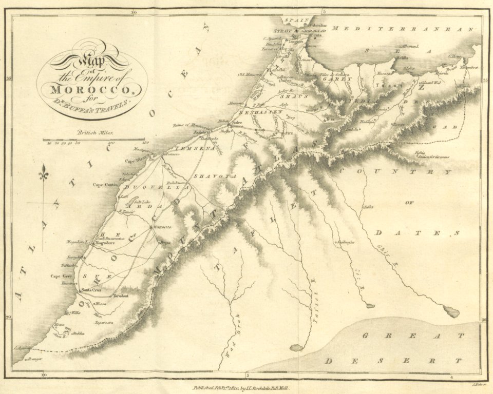
old maps of morocco
english-language maps
facundo melgares
collections of staatsbibliothek bamberg
franconian switzerland
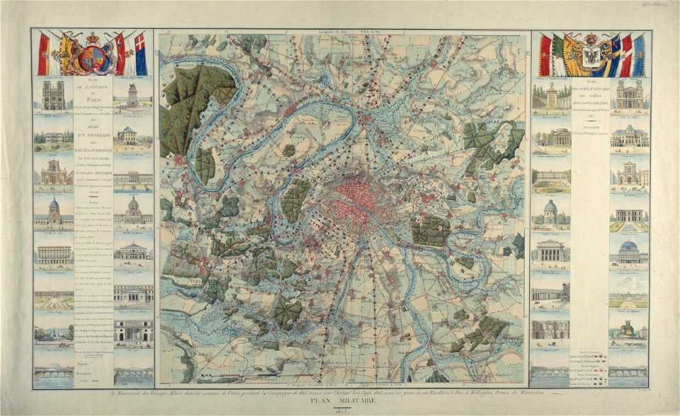
maps of paris from paris musées
1815 in paris
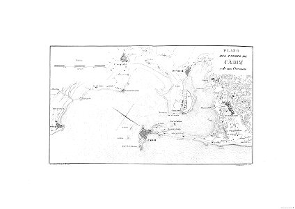
cádiz in the 19th century
scanned spanish texts
maps by royal bavarian land tax commission
old maps of freising
maps in the library of congress
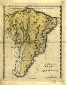
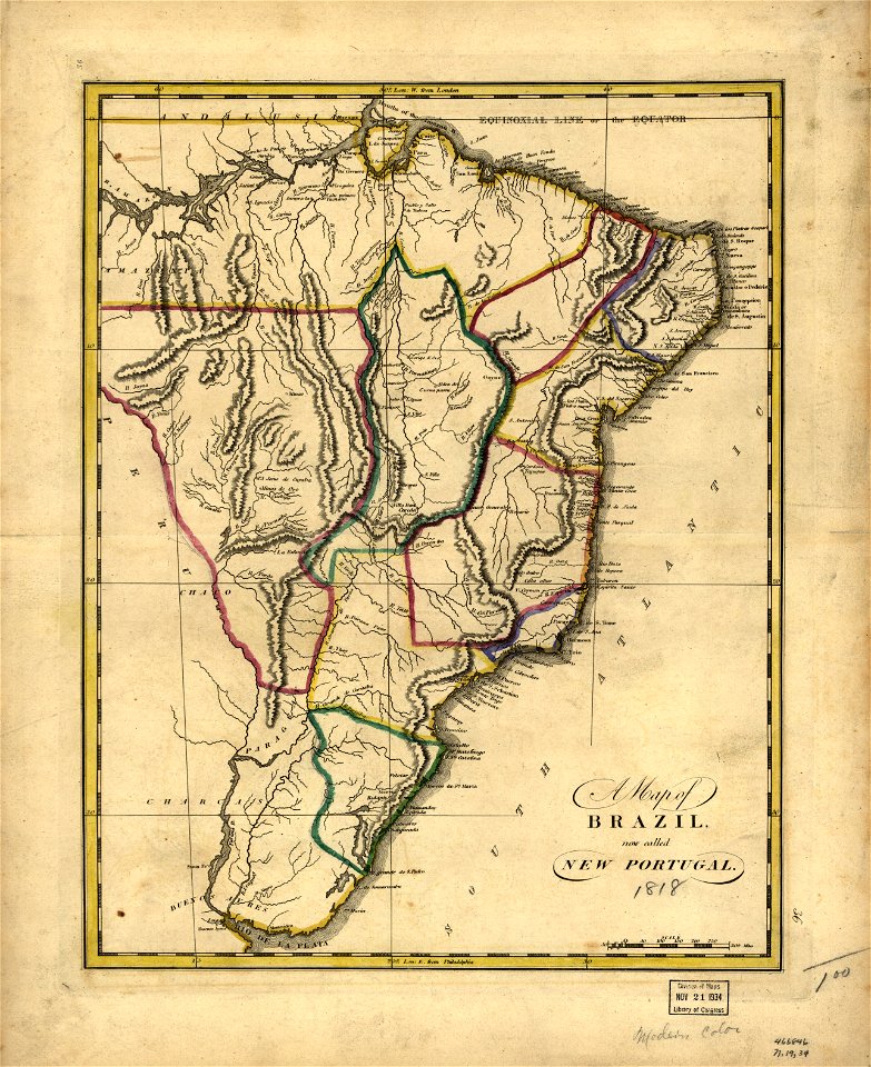
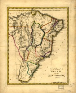
19th-century maps of brazil
maps in the library of congress
19th-century maps of brazil
maps in the library of congress
19th-century maps of brazil
maps in the library of congress
19th-century maps of brazil
maps by royal bavarian land tax commission
old maps of freising
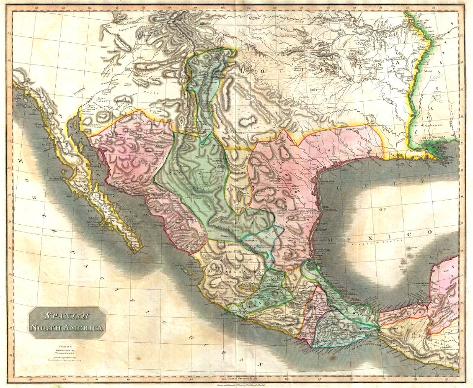
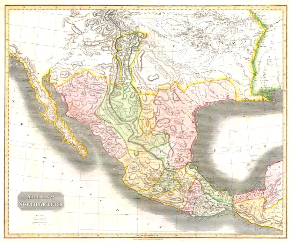
1810s maps of mexico
1814 in mexico
landscape
maps
maps of the eastern mediterranean
jr
old maps of the iberian peninsula
maps by john thomson
english-language maps
1814 maps
travels in various countries of europe
asia and africa
19th-century maps of the spanish empire
1810s maps of south america
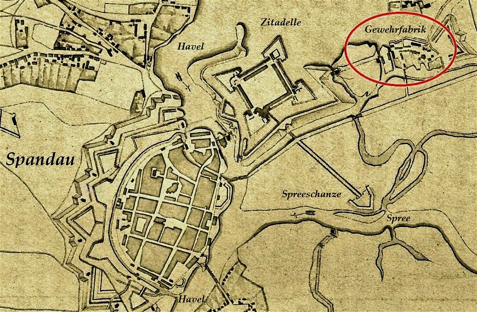
historical documents of the spandau citadel
festung spandau
old maps of the history of oceania
english-language maps
illustration
maps
hawaii in the 1810s
louis choris
travels in various countries of europe
asia and africa
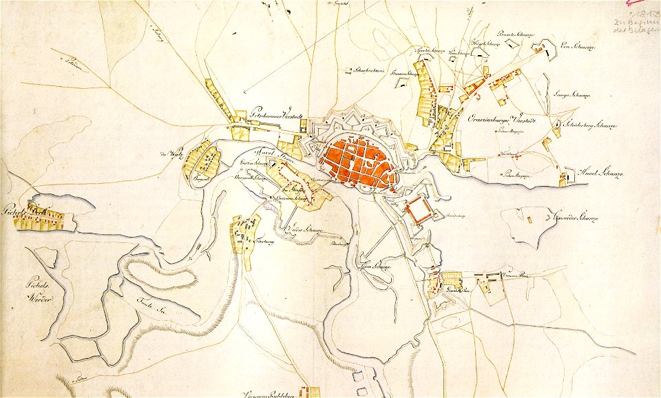
historical documents of the spandau citadel
festung spandau
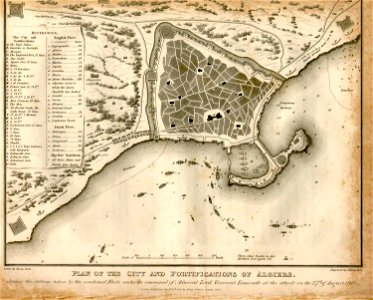
ottoman period in the history of algeria
1816 maps
old maps of greece
old maps of turkey
maps from the mechanical curator collection
1869 maps
cádiz in the 19th century
1812
travels in various countries of europe
asia and africa
don in rostov oblast
novocherkassk
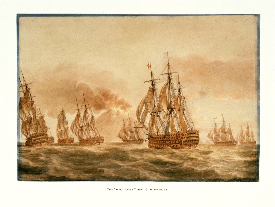
hms victory (ship
printing
choir of bremen cathedral
pages with isbn errors
joyce gold
printing
printing
1781
portrait paintings of ferdinand ii of the two sicilies
giuseppe bonolis
jean-baptiste mauzaisse
fougères
draped columns on pedestals in portrait paintings
attributed portrait paintings
portrait paintings of men holding baton
19th-century cabinet portraits
media contributed by the frick collection
naïve art
19th-century portrait paintings in the musée national du château de versailles
jean charles nicaise perrin
portrait paintings with natural background
jean lannes
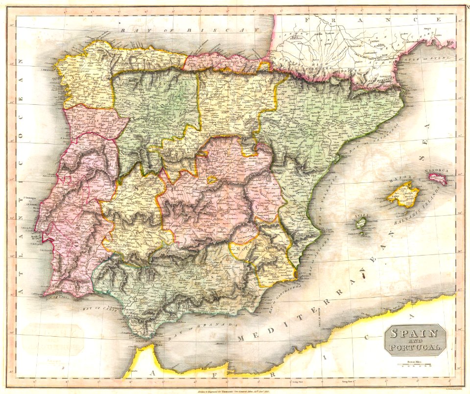
1810s maps of the iberian peninsula
maps of spain by tomas lopez
1810s maps of the near east
maps by john cary
1810s maps of the near east
maps by john cary
19th-century maps of vietnam
1810s maps of china
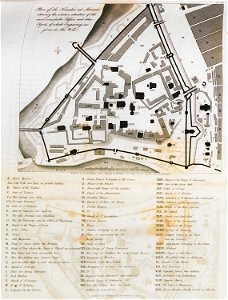
a voyage to abyssinia, and travels into the interior of that country, executed under the orders of the british government in the years 1809 & 1810
john outhett
1810 maps of north america
1810 maps of mexico
a voyage to abyssinia, and travels into the interior of that country, executed under the orders of the british government in the years 1809 & 1810
john outhett
a voyage to abyssinia, and travels into the interior of that country, executed under the orders of the british government in the years 1809 & 1810
john outhett
maps of the united kingdom of the netherlands
françois bohn
hudson river in the 19th century
steamboats of the united states
portrait paintings by michele gordigiani
scapigliatura
isaiah thomas (publisher)
1812 maps
works after polidoro da caravaggio
maps in the british museum
cary's new itinerary (1815)
1810s maps of england
19th-century maps of the malay archipelago
19th-century maps of southeast asia
portrait paintings by giuseppe duprà (house of savoy)
portrait paintings of marie josephine louise of savoy
gaspard de chabrol
maps from gallica
a voyage to abyssinia, and travels into the interior of that country, executed under the orders of the british government in the years 1809 & 1810
john outhett
mountains of the moon (africa)
1810 maps of africa
a voyage to abyssinia, and travels into the interior of that country, executed under the orders of the british government in the years 1809 & 1810
john outhett
map collection of leibniz-institut für länderkunde
1810s maps of the netherlands
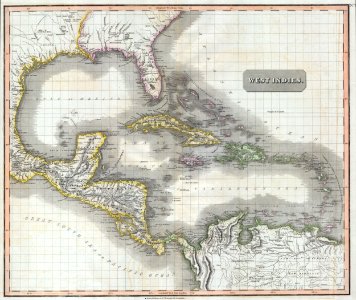
maps of the west indies federation
1810s maps of the caribbean
a system of modern geography (1810)
1810 maps of germany
maps of the rocky mountains
1810s maps of canada
maps of paris from the university of wisconsin-milwaukee libraries
plan de roussel
english-language maps
maps by john cary
portrait paintings of arthur wellesley, 1st duke of wellington
domenico pellegrini
maps of the united kingdom of the netherlands
1810s maps of the netherlands
a voyage to abyssinia, and travels into the interior of that country, executed under the orders of the british government in the years 1809 & 1810
john outhett
a voyage to abyssinia, and travels into the interior of that country, executed under the orders of the british government in the years 1809 & 1810
1810 maps of ethiopia
a system of modern geography (1810)
1810s maps of france
a system of modern geography (1810)
1810s maps of scotland
a system of modern geography (1810)
1810s maps of the pacific ocean
a system of modern geography (1810)
1810s maps of italy
a system of modern geography (1810)
1810s maps of china
a system of modern geography (1810)
1810s maps of iran
a system of modern geography (1810)
1810s maps of canada
1810s maps of the iberian peninsula
a system of modern geography (1810)
a system of modern geography (1810)
1810s maps of the russian empire
a system of modern geography (1810)
1810s maps of the austrian empire
a system of modern geography (1810)
1810s maps of germany
a system of modern geography (1810)
1810s maps of europe
a system of modern geography (1810)
1810s maps of arabia
a system of modern geography (1810)
1810s maps of turkey
a system of modern geography (1810)
1810s maps of switzerland
a system of modern geography (1810)
1810s maps of france
a system of modern geography (1810)
1810s maps of ireland
a system of modern geography (1810)
1810s maps of the balkans
a system of modern geography (1810)
1810s maps of the netherlands
a system of modern geography (1810)
1810s maps of asia
a system of modern geography (1810)
1810s maps of denmark
a system of modern geography (1810)
1810s maps of south america
a system of modern geography (1810)
1810 maps of the united states
maps by william home lizars
1810s maps of the world
1810s maps of the iberian peninsula
1813 maps of spain
a voyage to abyssinia, and travels into the interior of that country, executed under the orders of the british government in the years 1809 & 1810
john outhett
1810s maps of portugal
maps by tomas lopez
old maps of castilla la nueva
1765 maps of spain
a voyage to abyssinia, and travels into the interior of that country, executed under the orders of the british government in the years 1809 & 1810
1810 maps of ethiopia
1 - 100 of 201
Next page
/ 3